Features PannonRIS
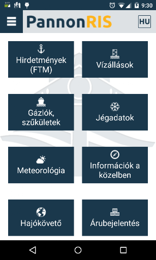
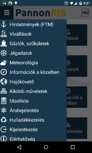
River Information Services (RIS) means the harmonised information services to support traffic and transport management in inland navigation, including, wherever technically feasible, interfaces with other transport modes.The PannonRIS system is permanently developed and operated in the framework of the co-operation between the Ministry of National Development, the National Transport Authority and the National Association of Radio Distress-Signalling and Infocommunications (RSOE).The PannonRIS mobile application offers the following continuously updated information for the stakeholders of inland navigation on the Hungarian section of the River Danube free of charge:• water level information,• notices to skippers,• shallow section information,• ice information.The application is developed by RSOE, provider of the Hungarian River Information Services (PannonRIS).www.pannonris.hu www.rsoe.hu
Secure & Private
Your data is protected with industry-leading security protocols.
24/7 Support
Our dedicated support team is always ready to help you.
Personalization
Customize the app to match your preferences and workflow.
See the PannonRIS in Action


Get the App Today
Available for Android 8.0 and above